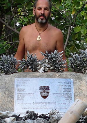
This page is an automated translation of /nl/tuamotus.html and is awaiting a manual review.
Despite the fact that we have grown to love the Marquises and its incredibly hospitable inhabitants, we are curious about the next destination; the Tuamotu with its idyllic uninhabited islands, crystal clear water and rich underwater life.
Weather forecast and banana rain
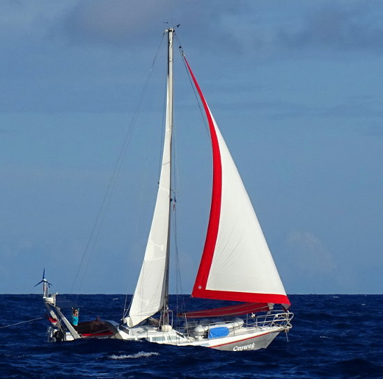
If there is enough wind, the crossing to the Tuamotu only takes about three days, but there are many people who have very bad memories of this trip. You sail through the SPCZ, the South Pacific Convergence Zone, the area where the air currents from the northern and southern hemispheres meet. A lot of material breaks, violent squalls come over, the sea is rough. So we are looking for a good weather hole with light wind, without an annoying conversion zone hanging between the Marquises and the Tuamotu and are satisfied with a crossing that therefore takes a day longer. If the forecast is correct, we will have four days of calm weather and arrive on a day with still a light breeze.
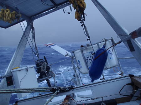
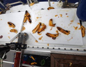
Yes, if the weather forecast were correct. It is therefore incorrect and that is often a problem in this area. Well, the first three days were nice and quiet and we lapped comfortably towards the next milestone in our journey, but on my last night watch we still get the wind in the front. Not literally, thankfully. There is a squall coming, a thick dark one with a lot of rain. Fast reefing, ensuring that there is not too much sail. Here it comes, I can hear the wind coming from a distance, even before it gets there. The wind that was there was only 12 knots but in this squall she is pulling to just over 30 knots and for 45 minutes we get a huge tropical downpour over us. It is raining thick drops of tropical rainwater and unfortunately also bananas. The bottom string of one bunch of bananas has come loose and with the strong wind and the violent movements of the boat, the bunch starts to dance and the ripe bananas to fall. Frans rolled out of bed with a sleepy face and asks if everything is going well. Except for the crushed bananas, it is fine! He puts on his life jacket on his bare body and takes a seat next to me in the cockpit and enjoys the free shower of tropical rainwater. The rain and wind rushes past our ears and we are crushed by the falling bananas. Yes, we do feel guilty that we are in a dent because it is a shame of the bananas of course, but now balancing on the aft deck to tie the rope again is an unnecessary risk so we do not do that anyway.
What are the Tuamotu actually
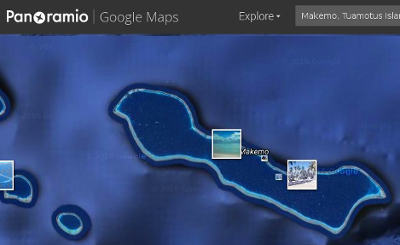
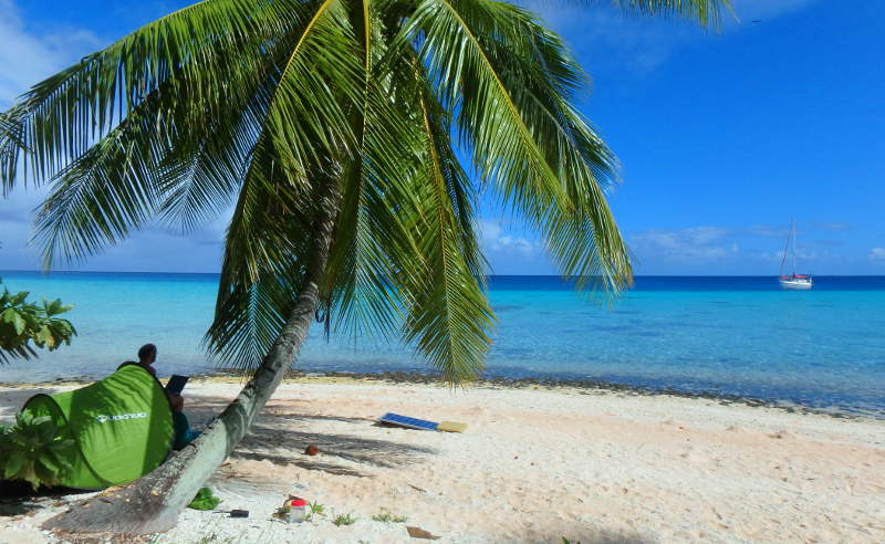
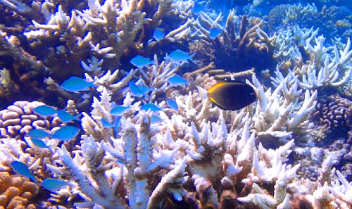
Tuamotu, Makemo
The archipelago lies a few hundred miles south-west of the Marquises. A nickname for the Tuamotu is 'the dangerous archipelago' and for good reason. Rock-hard, stony and sharp coral that unexpectedly rises steeply and erratically from the bottom of the sea. Unexpectedly, because the atolls that betray the reef are low, have no mountains, and because of the curvature of the earth you can only see the coconut palms when you are already very close. At least when it is daytime. For many former sailors, the unexpected blow hit hard after a small inaccuracy in the position determination. The stereotypical image of the castaway who is staring ahead on a tiny island with three palm trees comes from here. And as if the invisible reefs aren't spicy enough on their own, a sauce with spicy and unpredictable currents is added. Many ships have been lost here and many skippers sail around it. But to be fair, since the days of GPS, the skipper's life has been a lot less uncertain in this archipelago (because at least you know where you are, even when it is completely cloudy and dark!) And all in all, the risk is acceptable and the appeal great ...
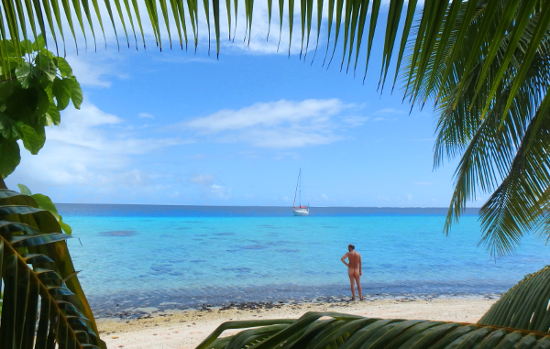
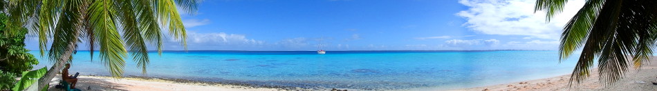
Because Tuamotu is also: crystal clear water, large 'inner lakes', or the lagoons where you can anchor without the boat being bothered by swell. Coral, rich in fish, rich in sharks, countless coconuts on uninhabited islands (motu), remote, unspoiled, palm trees with white beaches and the kingdom to yourself.
The Tuamotu consists of about 78 atolls and they spread over almost 1000 nautical miles, which is an enormous area. An atoll consists of a surrounding coral reef that blocks the waves of the sea. On the outside of the reef, the waves break and the water then flows over the edge and in through narrow passages. An atoll does not have to have any island (motu), but most have many wooded islands or really long large motus on two sides of the atoll. An atoll can be of any size, but most of them are large; 20 x 55 kilometers is very normal! In the inland lake, the lagoon, the water has been cleared of the swell of the sea. Many atolls are navigable because they are deep enough, but that does not apply to all. There are also often but by no means always navigable passes through which you can sail in and out of the atoll.
Now you should have a bit of an idea of the 'Tuamotu', something that few non-sailing people (or diving, it is also a diving paradise) have heard of. There are a number of atolls where it is more or less and relatively 'touristy' and these are the most visited by transit cruisers because they are the most on the route, the most accessible and have the easy passes. We actually prefer to go to atolls that are not so well known, so we will delete the atolls where it says in our book that they are 'frequently visited' or 'often visited'.
Help, the pass through the reef
Every sailor we speak to is a bit nervous when he or she arrives at the pass (a narrow passage in the reef); the combination of opposing currents and wind can make it extremely ferocious and dangerous and currents can reach far beyond what you can counter with even a very powerful engine ... It is important to gain weight when it is roughly standing water, so exactly in between two tides. But when that is is very difficult to predict and sometimes there is no stagnation but the water continues to flow out during both tides. It depends not only on the tide but to an even greater extent on the influence of wind and sea swell, which determines how much water is pushed over the reef and thus how much water wants to flow out of the lagoon. The more water that is pushed into the lagoon, the later the time of stagnant water occurs and if there has been a lot of wind it may well be that there will never be a standstill at all and that the water continues to flow hard out ... differs per atoll and per wind direction.
Raroia
This is our first atoll and we arrive nicely as planned an hour before the estimated 'still water time' at the pass of Raroia. We stay at a reasonable distance from the pass and watch what is happening with the boat speed and through the binoculars we see how wild or calm the water looks. As soon as we see that the pass looks calmer, we move a little closer and if our speedometer does not indicate any suspicious things, we are really sailing in the direction of the pass. When we arrive it is almost low tide in the lagoon. This means that water now flows out of the lagoon and that after the standstill it changes into flowing water. We would much rather have a counter current than a down current, because this is slower and therefore more controlled and in this case also because we have 20 knots of wind that comes exactly from the direction of the lagoon. Current and wind are best both in the same direction, otherwise you will get very high, steep waves! That is why we are early and as soon as it looks fairly quiet we give it a try.
"Frans, look, the middle part of the pass seems fairly quiet, do you think we can go through it now?" Frans says we should take a chance. We have been warned by others that slack (standing) water in this pass only lasts very briefly. If we wait too long, the current will reverse and the waves will become scary high and steep because the wind and current will go against each other. We think it is very exciting but give it a try. Slow down more gas and go with that banana (or what's left of it). There is still some counter current, just the way we want it. Frans is on the bow looking out for coral that is not on the map. We are in and that was actually a breeze!
Kon-Tiki
In Raroia we would like to go to Kon-Tiki Island. Thor Heyerdahl was stranded here-on the outside of the reef- in August 1947 with his famous Kon-Tiki. You can anchor well in this area on the inside of the reef. To get here we have to sail about 7 miles to the other side of the lagoon. That is also something that requires due attention. The water is for the most part 40 meters deep, but 'bommies', or entire coral islands, come to the surface in various places. Keeping an eye on your depth gauge is pointless, they are often straight pillars that rise steeply. They can be located at any depth and are not necessarily clearly visible ... There are no maps of this area, at least no modern maps calibrated with GPS data so we have to sail on sight. Good light is essential and that means especially no low sun in the direction in which you are sailing, then you cannot see anything because of the glare on the water. When we have passed the pass we see that the sun is good and we can therefore continue straight away. Frans is on the bow and I set the course on the autopilot.
We view the rough course on downloaded Google Earth maps. That's right, those are satellite photos from Google Earth where you can see the bommies lying below sea level because of the clear water. You can load those Google Earth maps into OpenCPN and that way we can see exactly where we are sailing on those maps. Very nice by the way, to sail around in an idyllic spot with your own ship! In the past, it was just daydreaming and zooming in on Google Earth and watching how special it must be at the very back of the globe ... Now we sail here ourselves (!!!).
The maps turn out to be very useful and afterwards Frans did not have to be on the lookout, we slalomed nicely around the coral by following the map. Nevertheless, we always have someone on the lookout, something may be missing on the map (as it turned out later!) And that risk is not worth it!
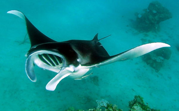
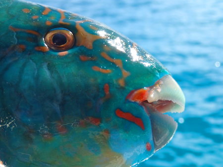
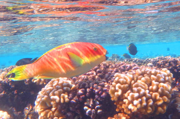
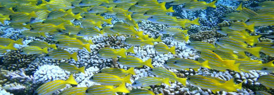
When we finally get to the other side of the lagoon, we see a second San Blas. Small uninhabited islands with white beaches and palm trees. For a moment we think "Have we really sailed that far to see the same thing again?" But later it turns out that it is still very worthwhile. The area here is much larger, it is many times less crowded in terms of sailors, there are no Kuna's but Polynesians and to be honest, the Kuna's are interesting in terms of culture, but we don't really have a click in terms of 'being able to become a personal friend'. . Polynesians are (in general!) Many times more open, warm, generous, better educated and they are 'closer', even though they are further away from NL in terms of distance. If you know what I mean ... Also nice is that the Polynesiers, unlike the Kuna's, do not make a mess, we do not see any waste in the lagoons and on the beaches and the villages of the atolls that we visit are super neat. The underwater life is also much more beautiful: in addition to large schools of colorful fish, there are also large manta rays, and sharks circle everywhere! All sailors agree: Until now San Blas was the most beautiful, but that now turns out to have been only an appetizer to what we see here!
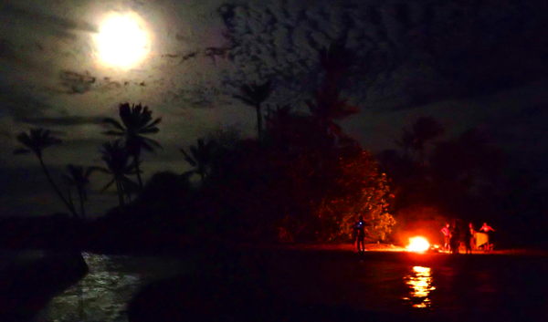
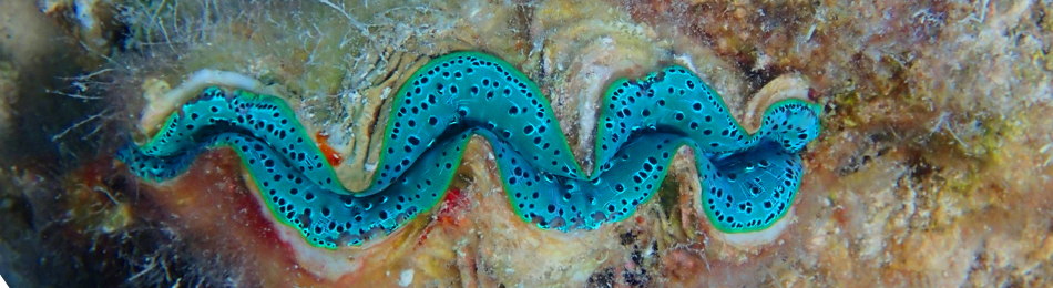
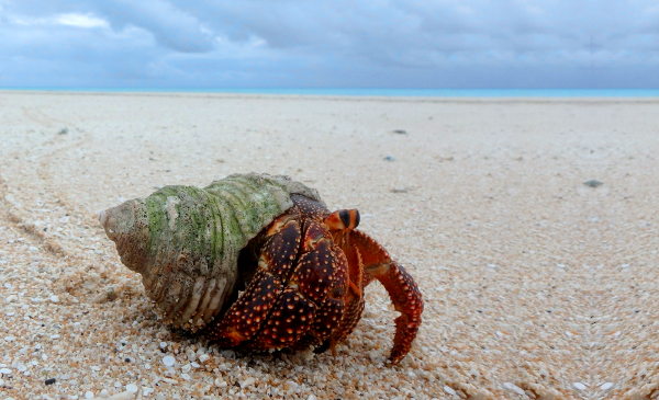
When we arrive there is only 1 other boat for miles around but an hour after arrival three fat catamarans arrive right next to us, right between us and the other boat! In the coming days, sailors we met earlier will also go to this anchorage. There is so much space and good anchorage in the atoll that you could easily pick out a private island, but we let the others know where we are and sometimes enjoy hanging out with other cruisers. Tactical Directions, Eye Candy, Esperanza, Plastik Plankton and Sahula are coming and the coming time is all about big campfires, cozy BBQ's and baking pizzas on the beach, snorkeling, exploring the countless islands, spear fishing and a visit to the Pearl Farm ( pearl farm). The water is super clear, the snorkeling is very nice. There are all new fish and countless 'Clams' (shells containing an animal that can have many different colors, very beautiful!). We also notice that there are many more fluorescent colors underwater than we have seen before. There are also more animal inhabitants on the island itself than we think; Great hilarity when we discover during a BBQ in the dark that large hermit crabs have discovered the cake baked by Plastik Plankton and cut pieces off it with their scissors and drag it to their hiding place :-D
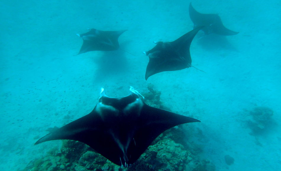
Manta rays!
It is a quarter past six in the morning and Frans and I are splashing into the water with diving goggles and flippers on; time for a morning dive (snorkel)! As we swim in the direction of a coral bommy, I look to the side and my heart beats double. A Manta Ray! And what a kind, it floats gracefully in my direction with its mouth wide open. Totally relaxed, calm and in his element, he is not impressed with me while I am crazy with enthusiasm for him. Wow, what an animal. So big, so majestic and graceful. We have seen them many times from Omweg in the Marquises and on the Galapagos but this is the first time that I have been close enough for him to swallow me. Unfortunately I don't have a camera with me but we're lucky, more mantas are coming and at one point the five of them are floating around us. A photo, I MUST take a photo so I swim at top speed to Detour to get the camera. When I return there are four more mantas and they stay for a long time. Wow....
Pass dive
Snorkeling inside the atoll is beautiful, but in the pass it is absolutely fantastic. There seem to be many, VERY many sharks, innumerable fish, many large groupers and beautiful coral. That sounds appealing to us and so we would like to do a pass dive but for that we have to sail 7 miles back.
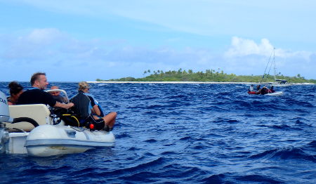
Tony on Tactical Directions offers that we can sail with his large catamaran, dragging the dinghy behind his ship, ideal! We then sail to the pass with four dinghies. The timing is critical, you want to start the dive when the water is still and then flow in so you never drift into the open sea.
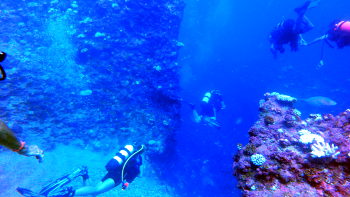
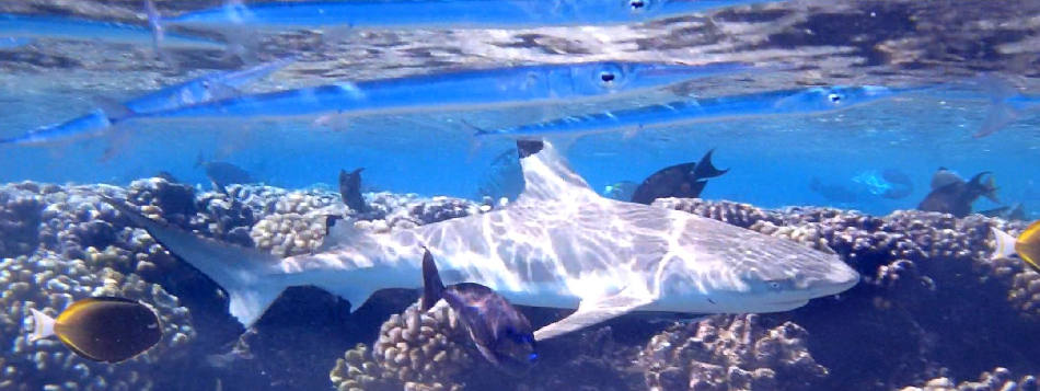
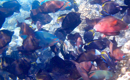
It is all going well and is quite an experience! When we descend diving, we first cross the pass through the gorges in the bottom. They are deep so we float between narrow upright walls about 25 meters below the surface and it feels very nice 3D. Once we have passed the gorges, we enter a wider area and see many sharks. Most of them are at a pleasant distance and show no interest in us at all, but a lemon shark (lemon shark in NL?) Comes a little too close to me. Someone who dives here a lot has been bitten by such a shark once. Gloep, not great for getting blood flowing around with so many other sharks around! Fortunately, the animal swims calmly and does not have an aggressive posture, but just to be on the safe side, I calmly move aside. There are many groupers. Not hundreds, as there could have been according to a local (it was expected that they would now be spawning en masse) but still there are many and furthermore we see large fields of beautiful living coral and many other fish floating along with the current. A very nice experience!
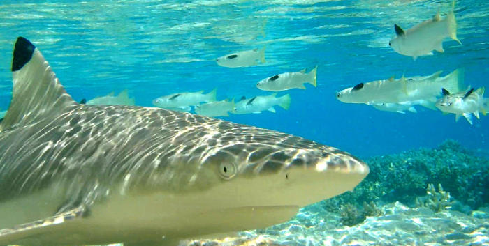
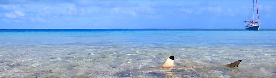
Sharks
Who's going to swim while it is full of sharks here? To reassure you, sharks are relatively harmless. There are only a few shark species that are large and bold enough to eat humans and these sharks are hardly ever found here. The sharks here eat fish and we don't look anything like that to even the most myopic shark. And there is a lot of fish, enough to satisfy the sharks' hunger. A non-starving shark will let it out of its head to attack something big and potentially dangerous if it can just eat the harmless, easy-to-catch small fish. Most sharks show no interest in our presence. Unless we throw fish waste in the water somewhere. It remains a fun game to throw some fish waste into the water somewhere on the edge of an island and to see how quickly the sharks notice it and how, even in 40 cm deep water with their fins above the water, they can remove the fish waste super fast. track down. And then you know that if you go spearfishing here you have to get out of the water like a spear as soon as you catch a fish. Frans goes spearfishing with Florian of the Esperanza and that is an exciting adventure.
Departure
When are you going to another place? When you are bored? Well, then we do not have to leave .... Still we sail to the next atoll, because we have a kind of schedule that we have to roughly adhere to in order not to run out of time. Our friends from Esperanza (Florian and Martina) will join us. The pass in Raroia goes like a rocket, we are being shot out. Because of the direction of the wind, it is better to go out of the pass with the current because the current and the wind will then go in the same direction. It's a bit fast but we know there are no obstacles so we don't worry about that and we are back on the open ocean!
Axing/Heaving to
We try to sail slowly to Makemo, then we arrive at the first daylight. If we arrive a little too early, Florian motivates us to lie down (heaving to). This is possible since we have a roller-furling jib but we have not tried it yet. It is a sailing maneuver that ensures that you can comfortably stay in more or less the same position. When you have arrived somewhere and you lower the sails, the sails have no air resistance and a sailboat suddenly rocks back and forth like a bath duck on the waves. Not very pleasant !! Sails are the stabilizing factor, so you actually want to leave it alone. But sails also provide propulsion, so if you don't want to go any further, that's a problem. Unless you put the jib and main sail in the opposite direction. Then you have wind pressure in the sails, which significantly reduces the bath duck effect, and you are not going anywhere. We roll out a small tip of the roller-furling jib, the main sail is double reefed and then we steer the boat so that the roller-furling jib is placed in the box and we secure the tiller. The effect is phenomenal. Suddenly there is complete peace in the boat, we only float very slowly with the current and the direction of the wind and we hardly swing any more. This is an ideal position to wait for the right time to enter the pass.
Makemo
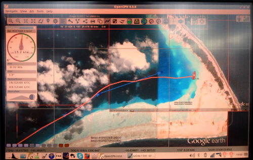
The pass in Makemo atoll is known for its spicy current. When we arrive there is - according to the tide data - a hard current in the pass. You don't want to shoot an unknown pass because it can go so fast that you don't have much to say and if there is unexpected shallowness, it can have fatal consequences. So we are reluctant to try to enter the pass too early; if the current is faster than our engine can handle, we simply cannot go back. So we wait patiently until the current shouldn't be very hard anymore, see what the pass looks like and Esperanza leads the way to see how it goes. To our surprise we see their speed on the AIS drop further and further. Would they keep reducing their engine power?
"Omweg, Omweg, Omweg, this is Esperanza" blares from the loudspeaker of the VHF. Florian tells us that the current is pouring out of line and that they cannot come up against it. Um, that's the opposite of what it should be .... It's just 7:30 AM and the radio network 'The Polynesan Magellan just' on 8.173 MHz USB has started. Frans reports us in: "This is Omweg in at the entrance of the Makemo pass and we are waiting for slack water and expecting ingoing current until then, but we experience outgoing current instead. Anyone who can share some insight on this?" Friends of sailors who have been to this atoll before answer and say that we should go in now because the current will be increasingly opposed. This is one of the times when there will be no stagnant water. Apparently there is so much water coming in on the other side of the atoll that - regardless of the tide - only water flows out on this side. We let Esperanza know what we have just been told and we make an effort to enter the pass. The current is indeed strong. But we have a Detour and a very effective propeller (autoprop) and a motor that is stronger than this boat would need. That combination ensures that we make it. Not very spacious, and it costs a lot of bruises on my legs when I use the tiller to navigate Detour between the swirling water mass. Man this is Panama Canal squared !! Everywhere huge eddies that want to take Omweg 180 degrees or more off its course and then that tiller between your legs is suddenly not very comfortable anymore. But we get through and we don't even need full power!
Esperanza is determined to get in too and we see them try three times. Unfortunately three times in vain, the engine is not strong enough and they are dragged backwards ... Unfortunately they have to give up. Too bad because we agreed to make music (they have a guitar, keyboard-piano and violin on board and you can go to your heart's content on an uninhabited island) and catch fish with a speargun. We were all looking forward to this, but it is not going as planned ...
We get a very nice anchorage from sailing ship Naoma. A secret place, we should not hang on the big clock where this is because if you make good anchor spots public, there is a real chance that the idyllic spot will suddenly become crowded. Although busy here is relative ... (For cruisers who want to go there: email us for the coordinates!) We are grateful to Ryan from Naoma for giving us the anchorage. Because there is bad weather with strong wind tomorrow and we have to lie in a sheltered place and at such a moment we cannot sail around ourselves to find something beautiful that has a good anchorage and shelter. Thanks to Ryan we can go straight to this island (motu) and anchor there before the strong wind really starts. Due to the pass it was already blowing over 20 knots, but this will become much more in the coming days.
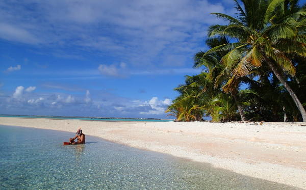
Shelterisland, our uninhabited private paradise
We arrive at a small uninhabited island with a beautiful palm tree forest on it and good sandy soil to anchor in front of it. We call the island 'shelterisland' because in the coming days it appears that - despite its small size - it provides very good protection. It is completely deserted around us. There is no one else to be seen within a radius of at least 10 kilometers! When we curiously sail to the island with the dinghy, we see a few sharks swimming. Fortunately, they are only black tips and they are not likely to do anything. The island turns out to be very beautiful and there is a small abandoned building that serves as a veranda and offers extra protection against rain showers and strong winds.
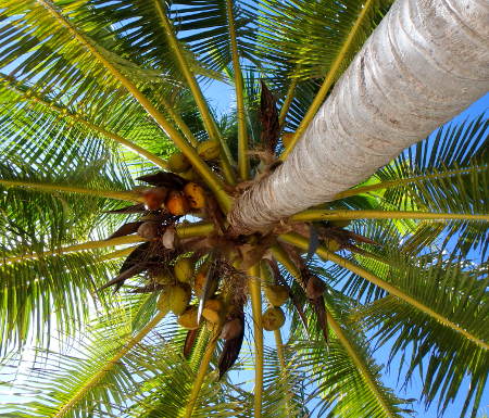
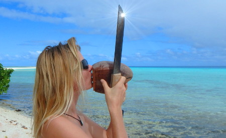
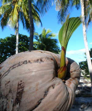
Coconuts coconuts and more coconuts!
Although the weather is not perfect in the coming days, we have an unforgettable beautiful time here. It is our own uninhabited island. There is no one for miles around. We see 1 other uninhabited island a few miles away and nothing but reefs where the meters high waves crash and the nearest other boats are so far away that we cannot see them. There are many coconuts on which we test our machete (machete) bought in the Marquis.
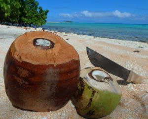
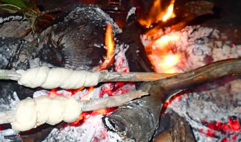
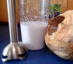
Every time we go to the island we take the machete with us. Thirst? Pick up coconut, chop it up and drink it! What do you mean a can or bottle? Hungry? Chopping some more and voila, you've got the coconut meat. Delicious !! And EITHER the coconuts are much better here, OR we have gotten used to the pure natural taste of coconut water and meat. We really like the taste now. When it is time in the evening for more than just coconut meat, we make a fire from wood and coconut residues that we gather on the island. Coconuts are in a thick fibrous shell, when it is dry, it is extremely suitable for serving as charcoal; it glows beautifully and gives a nice smoked flavor. On firm long green coconut palm shoots we roll a firm bread dough that we then turn over the flames to make a delicious sandwich. Add a coconut to which we poured some rum and tap (well, it sounds more like TOK); cheers! What a life!
The coming week we walk on the island, we explore the next uninhabited island, we enjoy the rough sea that breaks on the reef on the outside of the atoll and we snorkel that it is a pleasure. We gather coconuts, add rum or amaretto by the 'sundowner time' (the latter is a REALLY delicious combination ....!) And make pizza on the cobb with coconut fiber charcoal in the evening. We feed the leftovers to the crabs and sharks and enjoy the peace and freedom. After a week, we still haven't gotten bored and haven't seen anyone else. And the bad weather doesn't bother us at all here because shelterisland provides good shelter. It's warm enough so we don't need clothes. That saves washing again :-)
Explore further
On the Google Earth maps we see another part of Makemo that also looks very attractive. Very bright turquoise water and a large uninhabited island. Despite the fact that we do not want to leave our own sheltter island at all, we continue after a week and visit this part of Makemo. The last part of the journey there is exciting, it is full of bommies and we slalom around it. On the Google Earth maps there is cloudiness here, so this cannot be seen on the maps and we are completely dependent on our own view. It is worth it, we arrive in a very beautiful turquoise colored area that reminds us of the Tobago Cays, but without all the other boats. When we check the anchor and I take a hand of sand with me, we see that the sand is pure white and extremely fine. Parrotfish poo in optima forma, good poop guys! Indeed, large schools of parrot fish swim here. They eat dead coral and then defecate it like sand clouds. The island is large and it has an incredible amount of coconut palms. When we moor the dinghy, two wide men approach us. In their outstretched arms they hold two coconuts that they have just chopped open and give to us with a big grin. Welcome! They are two men from the village that is 10 kilometers away from here.
The men are here for two weeks to collect coconut, which is one of the sources of income here and this is the only purpose they have for this island, the rest of the time it is uninhabited. They are nice guys and the next day we give them in exchange for the coconuts grapefruit we still have from the Marquises. They appreciate that very much!
The only (but major) drawback to this island is that there are many biting insects. Unfortunately no sundowners on these beaches, then we get punctured. Unfortunately! But it is a very beautiful island to walk around well before sunset and the men allow us as many coconuts as we want and it is also great that there is so much dried wood that you can make beautiful large campfires.
After a few days we leave here again. There is another suitable anchorage in this atoll, but first we go to the village. We can anchor here when the weather is calm and that is it for a while now so we should quickly take advantage of that opportunity. It is a 10-kilometer boat ride to the village and meanwhile we stop at a bommy somewhere in the middle. I stop the boat, Frans jumps out with his snorkel gear on and explores the underwater life here.
Makemo, what a nice village!
There is no good anchorage near the village in Makemo and therefore you can only anchor safely with good weather (little wind) as is currently the case. We need the internet and it's finally here again! Very luxurious it even comes all the way to the anchorage and it is a good connection, but we are also the only ones here. When we enter the village we are amazed by the friendliness of the people here. They wave at us like we are long lost friends. Everyone laughs and waves and we wave and smile back happily. The village consists of 1000 inhabitants and is therefore not very small at all, but the people are really incredibly friendly and cheerful. The fact that the July party will start in a few days will probably also have something to do with that, everyone is busy and contributes to make it a festive affair. Palm leaves are woven, musical pieces are practiced, dances are rehearsed and it is buzzing with joy.
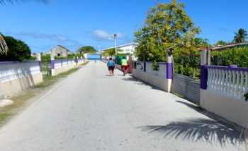
A striking fact is that the people here in this village use bicycles a lot. Everywhere you see people cycling and they are parked everywhere, it seems like the Netherlands!
We are looking for a shop to replenish some supplies. A man asks if he can help us. He turns out to be the owner of a shop and the shops are closed between 12 and 4 pm but he spontaneously opens the door for us and starts a nice chat. There is not much to buy and the range is strange, a mishmash of accidental foreign products. There is no poverty here, but supplies are always difficult in this remote corner.
When we walk back to the dinghy, we see a fishing boat with a large cooler with fish. In French we ask if we might be able to buy a fish. Wrong! No, not for sale, they insist on giving it as a present! We get an unbelievably beautiful deep blue large parrotfish in our hands. Please enjoy it they say with a smile and refuse to get anything for it. Wow .... What an incredibly nice people! That reminds us very much of the Marquises. Again a good indication that we are not seen as a cash cow here, but are just really nice. We would have liked to give some fruit from the Marquises in return, but we cannot find the people later.
But now the hard part. It is a parrotfish and a stunning deep blue. Gloep, we don't want to eat that at all, we want to enjoy it snorkeling! But then again, it is weird to ask if they have an ugly and mean looking fish ... We really have a lot of trouble destroying this beauty and frying it in a pan. Hypocritically, we have less trouble with it and fish tastes better if the fish in question is a fake-looking ugly predatory fish with a scary and dangerous-looking mouth.
The fourth anchorage in the atoll of Makemo
On the way to the other pass of Makemo (there are two navigable passes here), we stop at another anchorage. It is once again a beautiful desert island with lush palm trees and we have a good time with the crew of Sangvind. The island is beautiful but unfortunately quite a lot of stinging insects live here and moreover there are no unadulterated coconuts; everything has been gnawed open by rats on this island. We don't find a single coconut without a hole in it! Too bad for us, but the hermit crabs on this island are thriving. They are doing absurdly well on this island, when you walk around you have to be careful not to trample them and that is certainly due to the large amount of coconuts with holes that they can find here. The rats eat it, do not eat everything and the crabs celebrate an exuberant feast :-) Our Shelterisland was by far the most magical place in this atoll for us, although the rest is also really very beautiful paradise and we are getting worse to be spoiled...
The pass dive on this side of the atoll seems to be very special, but unfortunately it doesn't work out in terms of timing and weather forecast and we have to skip it.
Fakarava
Sangvind and we leave at the same time for Fakarava-south, which is a night sailing. A curse rests on us and we sail together with others because Sangvind suddenly discovers that the pass depth is actually very shallow for their three meter (!) Deep keel and decides not to risk it. We say goodbye on the radio, they sail on to Tahiti and we go for the south pass in Fakarava.
At the newly arrived we are initially shocked by the enormous breaking waves. It seems like a true surfer's paradise here! Nice for them but less so for Omweg. However, if we look closely, we see that there is a small area where the water seems to be calm and we see that we don't need to be at those breakers at all. If we carefully try to get in line, it turns out to be one of the easiest experiences yet! We take the shallow right side branch of the pass and sail through crystal clear water that is two meters deep. Believe me, that seems terrifying !!! We stab 1.35 meters so we have plenty of freedom under the keel but the coral is so visible through the transparent water that it REALLY looks like we are going to hit it, brrrr.
Passnorkel
Just after the pass, moorings have been constructed in a good place, we quickly attach Omweg to them, jump in the dinghy and soon start doing the pass snorkel/freedive. The pass is very popular with divers and snorkelers because there are so many species and such large quantities of fish. In the meantime there is an incoming current and with the dinghy we sail almost outside the pass, jump into the water and hold the dinghy with a line. We are automatically taken back in by the current. Wow what an experience!
While floating in the water we see more fish than before, we discover at least three types of beautiful fish that we have never seen before, we see impressively large specimens of 'Napoleon wrasses' for the first time, very large Titan Triggerfishes, many types of large groupers and we stand amazed by the number of sharks and for dessert the coral is beautiful too. The current starts to flow faster and faster and hand in hand we fly the last part at an emergency pace all the way to Omweg.
Hirifa
After the pass snorkel we release the lines from the mooring we sail to the sheltered anchorage Hirifa. There we will lie safely in the strong wind that has been predicted for the coming days. A few people live on this island, there is a restaurant and you can walk nicely and you can find many coconuts. Fakarava is one of the more touristic atolls, although you have to take it with a very large grain of salt. Tourist here means that there is something, that there are a few restaurants, that there are a few diving schools and that it is a bit busier. Everything still relative and in no comparison in terms of crowds with the Caribbean. Here in Hirifa there are a few nice old acquaintances and we meet a lot of new people, of which we build a very nice contact, especially with Scoots. The three days that we stay here are a lot of fun.
July 14th is approaching, the day the Bastille was stormed in the French Revolution in 1789. In France this is understandably a big celebration and here in Polynesia they use every reason to celebrate, so they also have big parties on this day. By the way, the Polynesiers go the extra mile because they just party all July! July 14th is the biggest spectacle and Tahiti is the place to be, so we see this as a good reason to make sure that we sail out of Fakarava on July 11th so that we will be on the 13th in the early morning in Papeete, the capital of Tahiti arriving. Before we go through the pass we want to do the pass snorkel again, so we sail to the mooringen in the morning on July 10th. Nice with a half wind we sail on the jib alone, without engine with 5 knots the 6 miles through the lagoon to the moorings. The timing is right and just when the tide turns we snorkel through the pass and because we are now pretty early, the current is not too hard at the end to do it again. Amazing experience! We end the day with a delicious pizza from the wood oven of a local guest house.
The pass the next morning is a breeze, despite the 25 knots of wind on the nose. We made sure we were on time so that the current and wind are in the same direction and so we sail out of the narrow passage without any problems (albeit a bit slowly). Tahiti, here we come!
Thanks!
For everyone who (ever) writes a comment on a blog: thank you, we appreciate that very much and we try to answer questions! You can also click on the thumbs up at 'rate' below. That is not linked to facebook or anything, so it will not be on your timeline, but then we know that you appreciate it. Only do if so of course !!